Arunachal encompasses the best of all that a traveller wants. This is a very special state that showcases the travails of history, the miracles of nature, the courage of man, and the helping hand of modern life. There are plenty of circuits to explore in this Land of Dawnlit Mountains, with Itanagar and Pasighat as the two ideal getaways to the tantalizing attractions of this remote and secluded state which has its borders with Myanmar, Tibet and Bhutan. More than 30 major tribes and many sub-tribes reside in more than 4000 scattered villages, with each tribe having distinct intuitive characteristics in terms of language, customs, spiritual traditions, social diversities and dress codes. Geographically, the western and northern border areas of the state are characterised by lofty, snow-capped mountains and sparse vegetation. The central zone of the state is the easiest to access via Itanagar due to better road network. The Himalayas here give way to spectacular river valleys such as Subansiri, Siyom, Siang and Dibang valleys, which are home to several indigenous tribes. Dense rainforests cover much of the eastern part of the state.
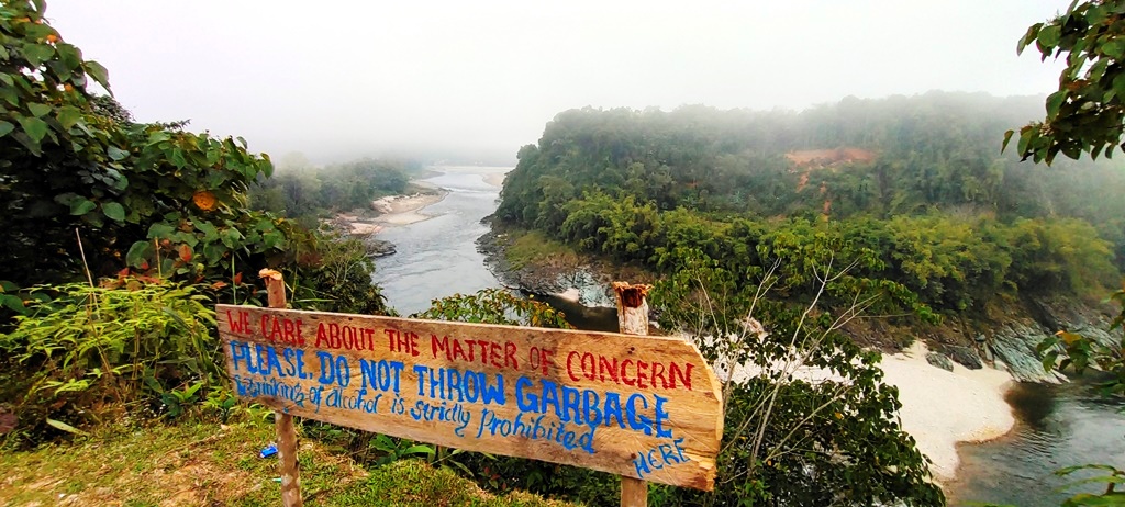
The route from Aalo to Menchukha goes past green meadows, interspersed with scattered tribal settlements and forest tracts. It follows the lyrical Siang River, to whom I can dedicate every verse of poetry, if I could write one. Truly, the extraordinary beauty of the Siang with those towering mountains half-covered in clouds, had me totally gobsmacked. The journey to Menchukha is a photographer’s delight – the road and the travel are themselves rewarding. Flowers in all colours grow in sparkling abandon; women with schoolgirl figures break stones and nurse babies; rocks break themselves; absent-minded Mithuns roam freely and lonely brown horses give mending roads a stateliness; tiny makeshift bamboo bridges stand over flirtatious streams; and clouds form surprising new shapes in the freshly scrubbed sky.
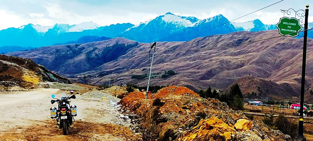
A quick stopover for delicious breakfast at the BRO Det in Tato had us recharged for the last 50-odd kms from Tato to Menchuka, which was the ‘real deal’ on this entire stretch. Ahead of Tato, the hillsides turned into enchanted forests with moss-covered trees, as the vegetation turns from tropical to alpine. After braving the slush and mud-covered broken ‘so called’ roads for almost two-hours plus, we saw the first tantalising snow-covered peaks, which announced the arrival of Menchukha.
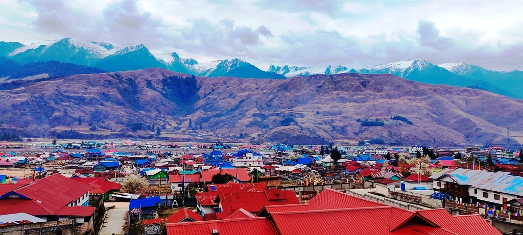
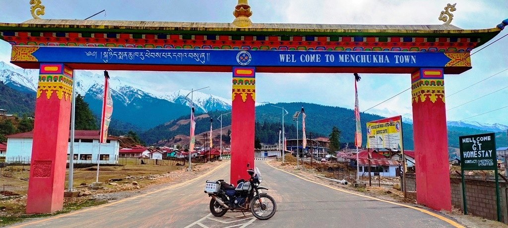
At the scenic Menchukha in West Siang, we marvelled at the bamboo suspension bridges swinging sturdily over the Menchuka (Yargap Chu) River. The icy-cold waters of this river here are believed to have medicinal properties, hence the name Men-Chu-Kha which comprises of three local words – ‘Men’ means medicinal, ‘Chu’ means water and ‘Kha’ means ice. The people of Menchukha are the peaceful, chhaang-drinking Buddhist Membas. The local Memba tribe, who follow Mahayana Buddhist principles, are extremely friendly and offered us their warm hospitality in terms of locally brewed Chaang (millet beer) with Paa (millet bread) and choicest of meat and vegetables. Chhurpi (local cheese) is their main ingredient in almost everything the locals cook here. We found ourselves invited to one such local Memba tribal house in a far-fledged village called Dechenthang, courtesy few dear Memba friends here.
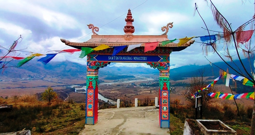
The following day, I rode up to the Samtem Yongcha Monastery, which is over four centuries old. This location is a must-visit, not only for the historical significance of this monastery, but also for the remarkable bird’s eye view of entire Menchuka valley and it offers some great photo opportunities. It was the morning time when young monks and volunteers were busy in cleaning up the monastery compound. There is a quiet beauty in seeing people work, especially when the work comes without visible rewards. I was suddenly filled with the desire never to leave this place. It’s such a strange contradiction, to feel attachment for a religious place that teaches detachment and the exfoliation of desire.
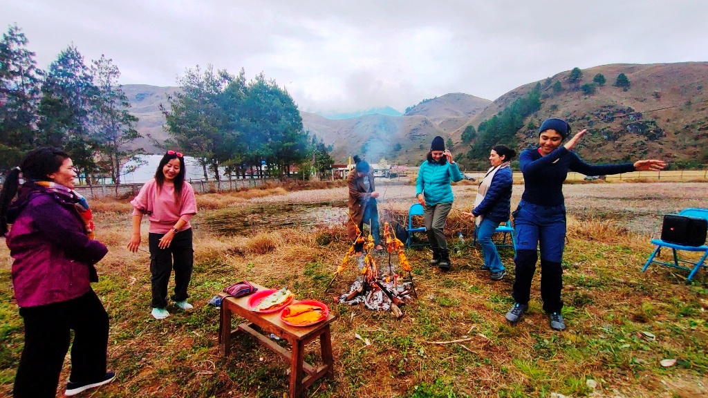
The rest of the day and evening was looking super exciting as our local friends invited us for a ‘cook-out session’ in their true Memba-style. We even went to the local meat market to pick up choicest of fresh pork, chicken and fish. This is the favourite place for locals here to go meat-shopping fresh produce and is set up in a very organised manner in a large open area by the river. The BBQ organised for us in a beautiful farm surrounded by snow-capped mountains all around was filled with fun, laughter, music and local dances. The mesmerising evening carried on till late hours of the night with our stomachs, hearts and minds all filled with local flavours.
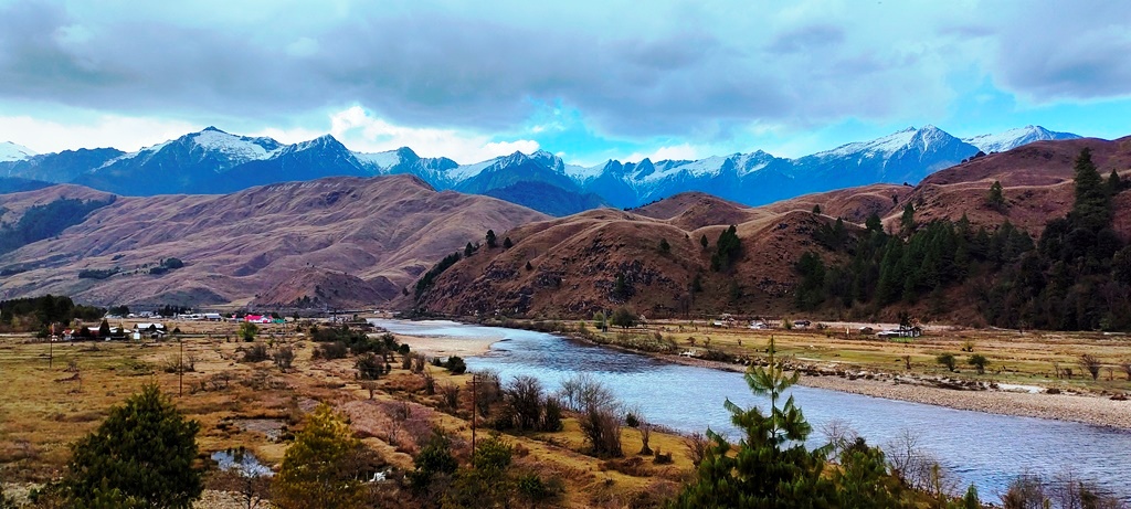
I am not sure how to describe the third day at Menhcuka and our excursions to nearby villages, with names such as Dorjeeling, Shekar, Galling and Dechenthang; in memory it’s hazy and dreamlike. We drove a little and walked around a little along the most spectacular sceneries and sights, across tiny wooden structures which enabled us to cross streams and also across few longer wooden hanging suspension bridges across the Menchuka River. At plenty of locations, the Menchuka Valley would open itself completely to us, offering the most astonishing views one can ever imagine. The snow-peaks offer a dazzling foil to the clouded blue skies and dazzling swathe of green on terra firma. This was truly “Paradise on Earth” and definitely the most picturesque place I have been to, in entire northeast (And mind you, I have covered quite a lot of northeast in past couple of years).
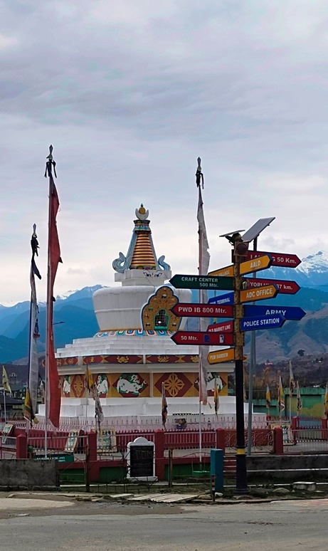
On our way back, following the river bank of mighty Siang from Aalo we rode to Pasighat, which was established in 1911 by the British. It is predominantly inhabited by the Adi tribe people (few of them are very dear friends) who are known for their colourful Ponung dance and war dance called Taapu. Primarily it was a settlement of Pasi and Minyong communities who still live in villages in & around Pasighat. River rafting on Siang is quite the rage here among the adventurous under the guidance of world-class professionals. The Daying Ering Wildlife Sanctuary is only 13kms away, accessible only through boat cruise across Siang River and is worth visiting. The archaeological site of Malinithan (100km from Pasighat) is linked to the legend of Lord Krishna and his wife Rukmini. The dismembered head of Sati (Parvati) is said to have fallen at Akashiganga (near Malinithan) according to ancient Hindu mythology, and this is a highly sacred place for Vaishnavites. The historic town of Jengging known for showcasing the freedom fights by brave Adi tribe with the British and Mouling National Park are also in vicinity in Upper Siang District. Pasighat forms the gateway to the pristine Dibang Valley, a scenic valley carpeted with orange orchards and surrounded by majestic mountains. I will be covering about these other valleys of Arunachal separately in subsequent blogs.
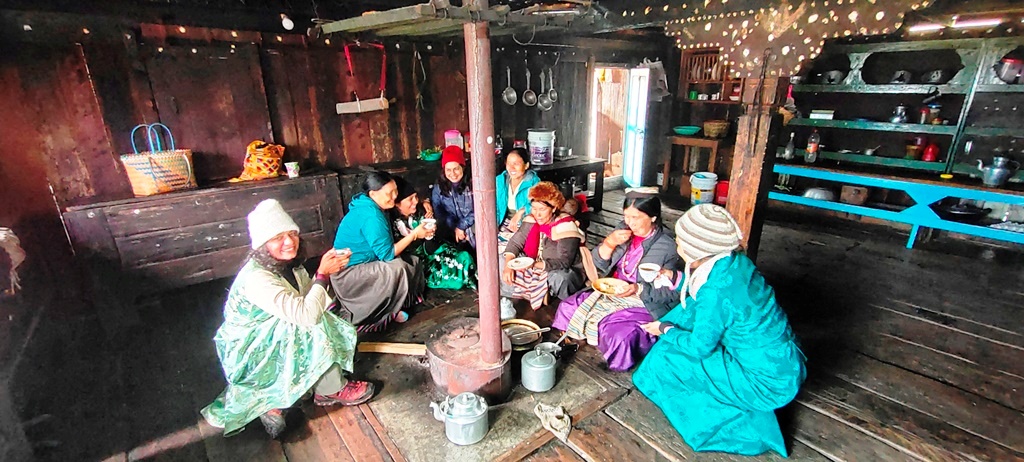
Arunachal Pradesh is a stunning hermitage that croon stories of all kinds, where you are either climbing up or winding down hills. The beauty and the myths, the drama and the reality, of its natural setting, the traditions, customs and collective heritage of its numerous tribes and sub-tribes of Indo-Mongoloid origin, all these are the very heart of Arunachal’s fabulous allurements. Arunachal Pradesh is among nature’s last frontiers, where Mother Earth retains its original pastures and pleasures, and where indigenous tribes still live reasonably unpolluted lives. This state is probably one of the last remaining outposts in the country where tribes still live a primitive existence, seeking out a living from the land and maintaining a harmonious relation with nature. Till today, Arunachal Pradesh continues to be one of the greatest and last remaining repositories of unique culture and unexplored ecological wealth. Therein lay the real charm of this place. Arunachal is the perfect example of “Shangrila – Undiscovered & Unspoiled”.
nice